What's Happening Right Now
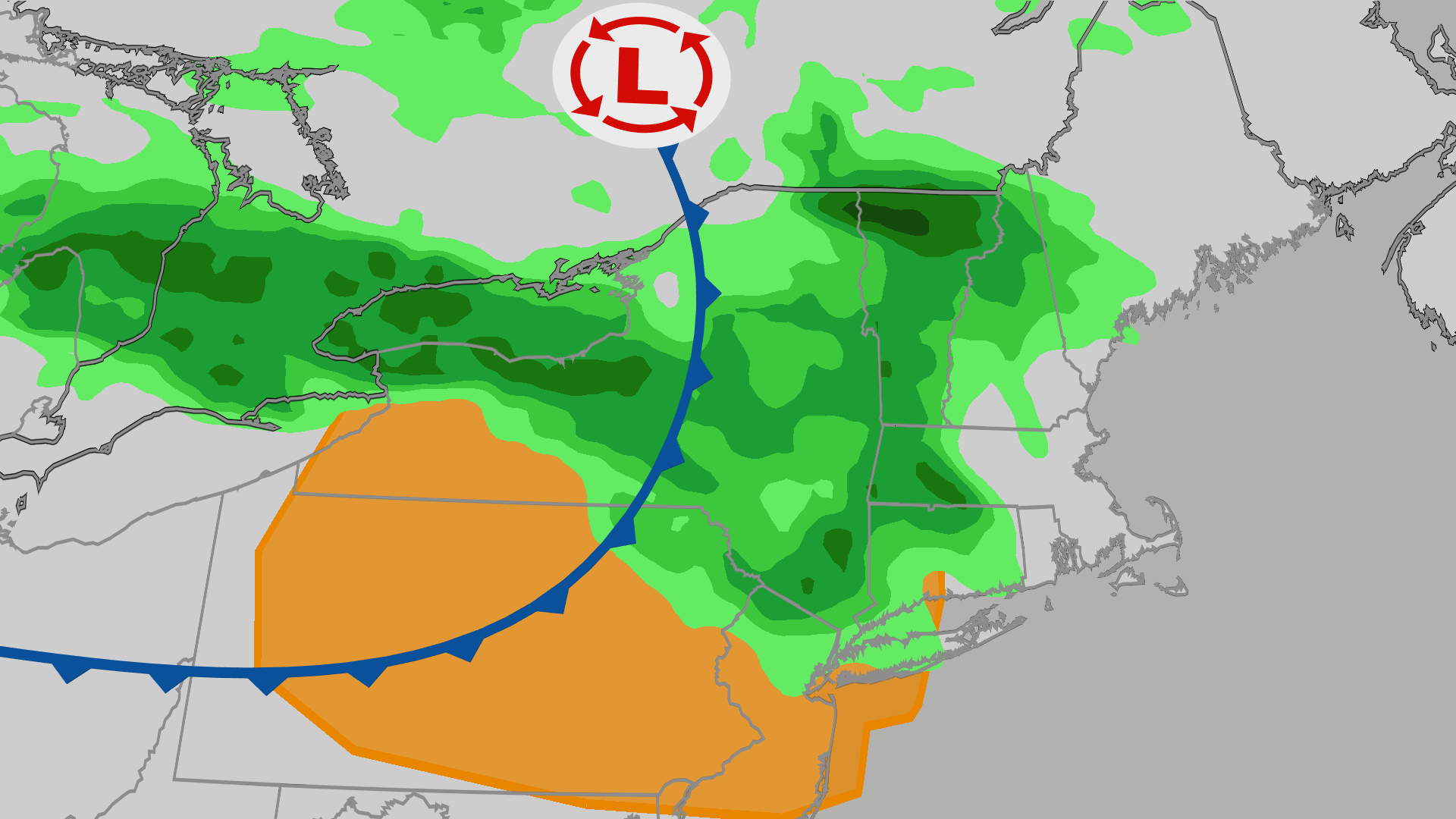
A fast-moving belt of stormy weather is targeting large parts of the Northeast and mid-Atlantic. The active weather pattern brings an immediate risk of severe thunderstorms, damaging winds, large hail, and even a localized tornado threat through early Friday morning.
Forecasters note that the highest risk zones stretch from parts of the upper Midwest down into the mid-Atlantic states. Multiple clusters of organized storms are driving the current weather alerts, keeping emergency management teams on high alert across several states as the system feeds off lingering seasonal heat and moisture.
The Meteorological Context
This severe weather outbreak is being fueled by a potent upper-level disturbance clashing with an unstable, warm airmass currently entrenched across the eastern half of the country. High atmospheric shear—a change in wind speed and direction with height—is helping organize individual thunderstorms into aggressive, fast-moving clusters and line segments. This dynamic environment accelerates wind speeds just above the surface, allowing intense gusts to mix down into populated areas with little advance warning.
Why It Matters
While heavy rain and localized flooding remain minor concerns, the primary hazards associated with this specific system are severe straight-line winds and large hail.
Damaging winds pose a substantial, immediate risk for knocking down trees, snapping utility poles, and causing widespread power outages that could impact hundreds of thousands of residents and disrupt evening commutes. Certain high-risk pockets—particularly in northeastern Ohio, western Pennsylvania, and portions of the mid-Atlantic corridor—face an enhanced local wind threat where gusts could exceed significant thresholds. Meanwhile, communities in the upper Midwest are tracking large hail capable of denting vehicles and damaging property.
The Tornado Risk
In addition to straight-line winds and hail, atmospheric profiles indicate favorable conditions for a few brief, spin-up tornadoes to develop. Meteorologists indicate that the wind shear dynamics could support one or two stronger, fast-moving tornadoes embedded within the broader squall line, making rapid shelter execution critical for anyone in the path of the warning polygons.
What's Next / Future Outlook
The severe weather threat will shift southward by Friday as the primary cold front pushes off the coast and stabilizes the atmosphere in the Northeast. The active storm corridor will slide into southern Virginia, West Virginia, and North Carolina before weakening over the weekend. Residents in these upcoming target regions are advised to monitor local forecasts closely and ensure they have multiple reliable ways to receive overnight severe weather alerts.


