Why the South Is Drowning: A Relentless Storm System Descends
The phrase "when it rains, it pours" is taking on a terrifyingly literal meaning for millions across the Southern US, Gulf Coast, and especially Texas this week. A potent, persistent storm system is gearing up to unleash days of torrential rainfall, raising the specter of widespread and potentially devastating flooding. This isn't just a typical summer shower; forecasters are warning of a significant and mounting flood threat through Friday, with specific regions in Texas facing an elevated danger due to storms repeatedly tracking over already saturated ground.
This impending deluge isn't just about inconvenience; it's about the very real risk of lives and livelihoods being impacted. We're talking about millions of people from the vibrant streets of New Orleans to the sprawling urban centers of Houston, Austin, and San Antonio, all under the shadow of a serious weather event. But why is this happening now, and what makes this particular threat so concerning?
Echoes of Disaster: Missouri's Recent Flooding & Texas' Vulnerable History
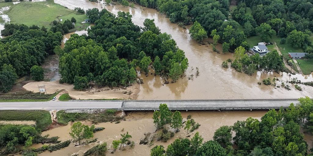
The alarm bells are ringing louder because this current forecast follows on the heels of deadly flash flooding that ravaged southeastern Missouri just last weekend. Places like Iron and Reynolds counties experienced an unimaginable 9 to 12 inches of rain in mere hours, leading to Flash Flood Emergencies, swiftwater rescues, and widespread devastation along the Black River. Images of submerged homes and stranded vehicles serve as a stark reminder of nature's raw power.
For Texans, the threat carries a particularly grim historical weight. Vulnerable areas along the Guadalupe River in Texas Hill Country are once again in the crosshairs – the very same region that endured catastrophic flooding on July 4th last year, claiming an astounding 135 lives. When meteorologists warn of storms repeatedly tracking over these historically flood-prone zones, it's not just a technical detail; it's a chilling reminder of past tragedies and a call for heightened vigilance.
Decoding the Deluge: The Science Behind the Southern Storm Pattern
So, what's fueling this atmospheric firehose? It's a classic summer storm setup, but with a twist. A weak cold front is slowly sagging southward, acting like a trigger. As it pushes into the warm, incredibly humid air rising off the Gulf of Mexico, it creates the perfect recipe for sustained, soaking thunderstorms. It's a collision of air masses, with the Gulf's moisture providing an endless supply of fuel.
Adding another layer to this meteorological puzzle is a massive heat dome currently parked over the northern half of the country. This high-pressure system is essentially steering a weak storm system right underneath it, forcing it from east to west straight into the Southern Plains by mid-week. This unusual trajectory means more opportunities for persistent, heavy rain bands to develop and linger over the same areas.
Regions in the Crosshairs: Who Is Under the Heaviest Flood Warning?
NOAA's Weather Prediction Center (WPC) has already issued a Level 2 out of 4 risk of flash flooding for a massive swath of the country on Monday. This stretches from Western North Carolina all the way to Texas' Big Bend, encompassing:
- Southeastern Virginia
- East Tennessee
- South Carolina
- Georgia
- Central and Southern Alabama
- Central and Southern Mississippi
- Much of Louisiana
- Eastern Oklahoma
- Much of Central and Western Texas
This includes major population centers like New Orleans, Houston, Austin, San Antonio, and parts of the Dallas metroplex. Forecasters project widespread totals of 1-3 inches of rain across the Gulf Coast into Central Texas through Tuesday.
As the week progresses, the threat intensifies and shifts:
- Tuesday: The primary flood risk pivots to the Texas Plains, including Austin and San Antonio, while storms continue across the Southeast (Atlanta, Birmingham, Mobile, New Orleans).
- Mid-Week: The most significant rainfall totals – an alarming 5 to 8 inches – are poised to drench West and Southwest Texas, specifically targeting the vulnerable Hill Country. A Level 3 flash flood risk is currently in effect for parts of the Big Bend, west and north of San Antonio, indicating a significantly higher likelihood of dangerous flash flooding.
Preparing for Impact: What Millions in Texas and the South Need to Know
This isn't a time for complacency. The FOX Forecast Center explicitly states that "Flood watches will more than likely be needed at some point," a strong indicator that conditions are ripe for severe flooding.
For anyone residing in or planning to travel through these affected regions, especially those considering trips to places like Big Bend National Park, vigilance is paramount. This means:
- Monitor Local Advisories: Stay glued to local weather reports and emergency service warnings.
- Know Your Terminology: Understand the difference between a flood watch (be prepared) and a flood warning (take action).
- Have a Plan: Identify evacuation routes and have an emergency kit ready.
- Never Drive Through Floodwaters: "Turn around, don't drown" is not just a slogan; it's a life-saving directive.


