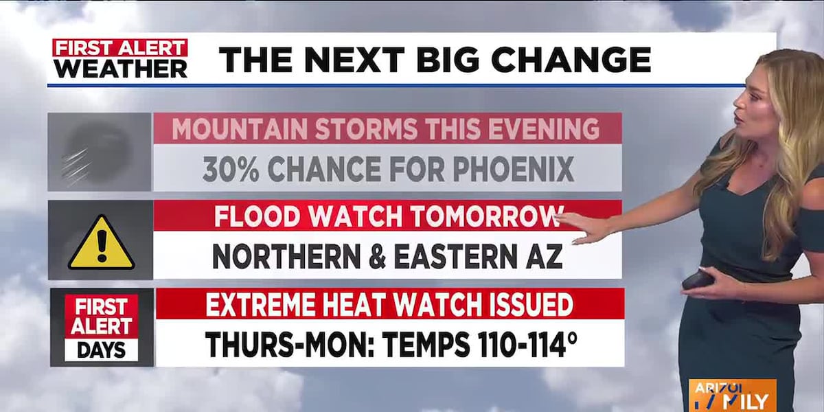
Welcome to Arizona, where the forecast reads like a weather thriller: one minute you're melting in unprecedented heat, the next you're dodging flash floods. This week, the Grand Canyon State is living up to its dramatic reputation, with Phoenix and its surrounding metro area under an extreme heat watch, while vast swaths of northern and southeastern Arizona brace for potential flash floods. It's a stark reminder that even a desert climate can throw diverse and dangerous weather curveballs.
Phoenix Weather Alert: Extreme Heatwatch Declared for Southwest Arizona
Starting Thursday and extending through Monday, the mercury in Phoenix is set to rocket. Forecasters have issued a First Alert Weather Day as temperatures are expected to soar into the 110 to 114-degree Fahrenheit range. This isn't just uncomfortable; it's dangerous. Extreme heat can quickly lead to heatstroke, exhaustion, and even death if proper precautions aren't taken.
How to Stay Safe During Phoenix's 114-Degree Heatwave
When the desert bakes, common sense becomes critical. If you're spending time outdoors, here’s what you absolutely need to do:
- Limit prolonged sun exposure: Especially between 10 a.m. and 6 p.m., the sun's rays are at their most brutal. Seek shade or stay indoors during these peak hours.
- Hydrate constantly: Drink copious amounts of water, even if you don't feel thirsty. Avoid sugary drinks and alcohol, which can dehydrate you.
- Take frequent breaks: If you must be outside, find air-conditioned spaces or cool, shaded areas to rest regularly.
Northern Arizona Braces for Flash Floods Amidst Heavy Monsoon Rains
As Phoenix contends with scorching heat, a completely different, yet equally perilous, situation unfolds elsewhere in the state. From 11 a.m. to 10 p.m. on Tuesday, a flood watch is in effect for much of northern and southeastern Arizona, including major areas like Flagstaff, Payson, and Globe. Showers and thunderstorms are expected to dump a significant amount of rain – potentially 1 to 2 inches – over a short period.
Understanding Flash Flood Risks in Flagstaff, Payson, and Globe
The danger here isn't just the rain itself, but the landscape. Arid ground struggles to absorb sudden, heavy downpours, leading to:
- Flash flooding: Rapidly rising water can turn dry washes into raging rivers in minutes.
- Excessive runoff: Rivers, creeks, and washes can quickly overflow their banks, creating hazardous conditions for communities and roadways. Always remember: "Turn around, don't drown."
Arizona's Weather Rollercoaster: What to Expect Day-by-Day
The forecast for the coming week reveals a dynamic, almost schizophrenic, weather pattern across Arizona.
Monday's Forecast: Gusty Winds and Isolated Storms in the Valley
Phoenix will see highs around a more "average" 106 degrees on Monday. There's a 30% chance of showers and thunderstorms in the Valley come Monday night, with the best likelihood in the higher terrains east of the city. Even if rain doesn't directly hit Phoenix, outflow winds from nearby storms could whip up gusty winds and create areas of blowing dust, a common desert phenomenon that can severely reduce visibility.
Midweek Outlook: Cooler Temps Before the Heat Returns to Phoenix
Tuesday offers a slight reprieve, with Phoenix highs dropping to a "cooler" 103 degrees and another 30% chance of afternoon and evening storms. By Wednesday, temperatures will creep back up to around 108 degrees, with only a slight chance of an afternoon shower. But don't get too comfortable; the major warming trend sets in late this week, ushering in the extreme heat watch from Thursday onward.
Meanwhile, the High Country will continue to experience scattered showers and thunderstorms through midweek, before the storm activity becomes more isolated towards Thursday and Friday.
Is Arizona's Monsoon Season Delivering? Early Rainfall Totals Reviewed
Despite the immediate heat threat, Arizona's monsoon season appears to be off to a robust start in many areas. For instance, Flagstaff has already recorded 2.74 inches of rain since June 15th, significantly surpassing its normal monsoon-to-date total of 1.47 inches. This early activity is a welcome sight for water resources but also underscores the risk of flash flooding in susceptible regions.
Why Monsoon Activity Matters for Arizona's Ecosystem and Water Supply
A healthy monsoon season is critical for Arizona's delicate ecosystem, replenishing parched landscapes, filling reservoirs, and providing much-needed relief from the relentless summer heat. However, the intensity and localized nature of monsoon storms mean that while some areas thrive, others face immediate dangers from sudden deluges.
As Arizonans navigate this week's extreme weather, vigilance and preparation are key. Stay informed, stay safe, and understand the unique challenges that each weather alert brings.


