New Englanders are waking up to a severe case of meteorological whiplash. Just as the region began wrapping up a grueling multi-day heatwave that saw Boston bake in 90-degree temperatures, the atmosphere took a violent turn.
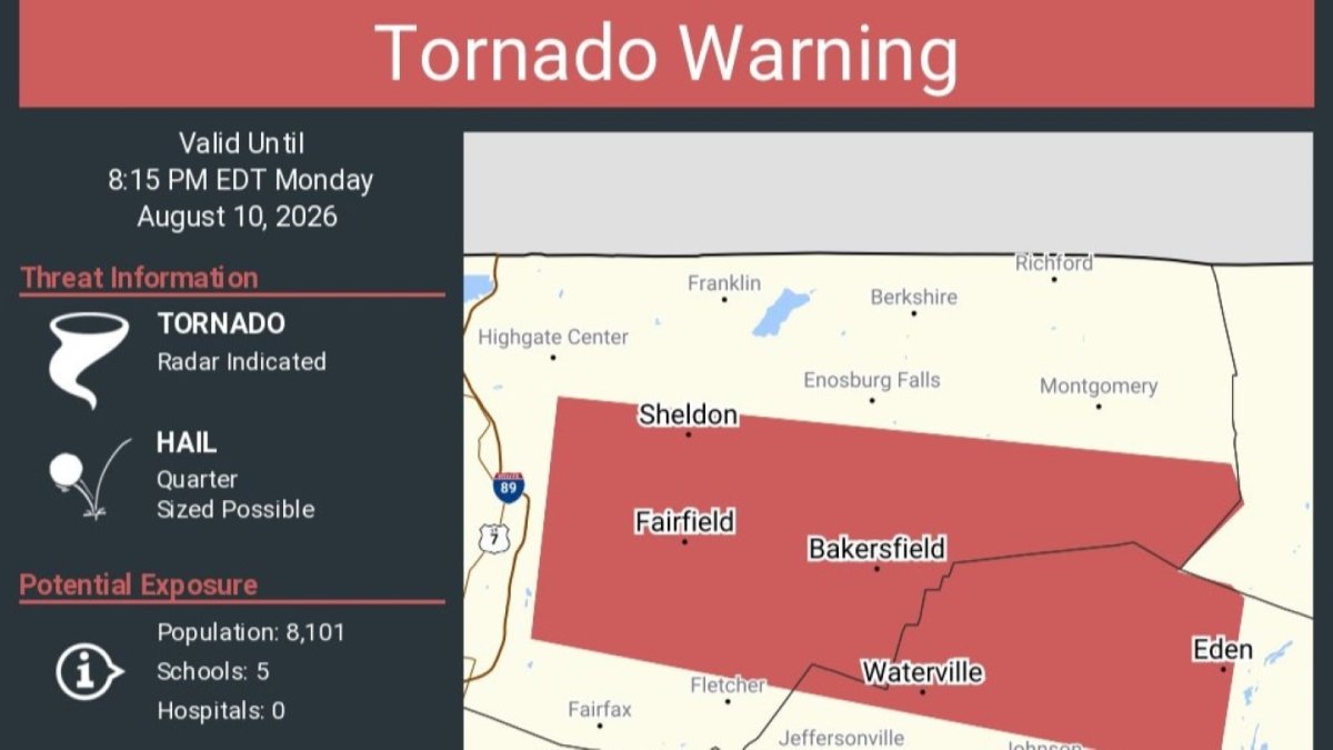
On Monday evening, skies darkened, sirens wailed, and the National Weather Service (NWS) issued urgent tornado and severe thunderstorm warnings for parts of northern Vermont.
Here is what happened, what is coming next, and why this hyper-volatile weather pattern matters.
From Sweltering Heat to Sounding Sirens
The weekend was defined by oppressive, sticky heat. Boston officially hit its third consecutive day of 90-degree weather on Sunday, solidifying an official heatwave. Monday kept the furnace running, pushing temperatures back into the high 80s and low 90s with stifling humidity.
But that high-energy, moisture-rich air mass acted as high-octane fuel when a cold front began to slice into the region late Monday afternoon.
By Monday evening, the atmosphere boiled over:
- Tornado Warnings: A sudden tornado warning was triggered in northern Vermont, covering Bakersfield, Fairfield, Waterville, and Eden.
- Ground Damage: While meteorologists are still assessing whether a funnel cloud actually touched down, the storm's straight-line winds did plenty of damage. In western Franklin County, Vermont State Police reported multiple downed trees and power lines, forcing the closure of Bushey Road.
- Flash Flood Threats: Close on the heels of the wind threat, the NWS issued warnings for flash flooding as torrential downpours stalled over saturated ground.
Why It Matters: The Physics of Atmospheric Whiplash
To the average commuter, a sudden shift from a heatwave to a tornado warning feels like a fluke. To meteorologists, it is a textbook display of thermodynamic energy.
When extreme heat and high humidity linger over an area, they create a highly unstable boundary layer. When a cooler air mass collides with this warm dome, it forces the hot, moist air upward rapidly. This rapid updraft is the exact recipe needed to spawn severe convective supercells, microbursts, and—in the worst-case scenarios—rotation.
Add to this the ongoing threat of Canadian wildfire smoke blowing southward, and you get a chaotic cocktail of air quality alerts, flood risks, and severe storm damage all in a 24-hour window.
The Outlook: Haze, More Rain, Then Sweet Relief
If you are tired of the extreme fluctuations, there is some good news on the horizon, though you will have to navigate a hazy Tuesday first.
- Tuesday: The immediate severe storm threat has passed, but wildfire smoke drifting into the upper atmosphere will paint the skies with a distinct, milky haze. Temperatures will remain warm (in the 80s), but humidity will begin to drop by the afternoon.
- Wednesday: Expect a spectacular mid-week breather. Highs will hover in the mid-to-upper 80s with significantly lower humidity and clearer skies.
- Thursday: Keep your umbrella close. Thursday brings the next major weather maker of the week, with scattered morning showers and thunderstorms. If the front slows down, we could see another round of strong-to-severe storms by Thursday afternoon.
- The Weekend: The ultimate payoff arrives Friday. A beautiful, dry Canadian air mass will settle over the Northeast, dropping highs into the comfortable 70s and low 80s with virtually zero humidity.
The Bottom Line: New England’s weather is becoming increasingly characterized by these rapid, high-impact transitions. While the weekend promises autumn-like perfection, the sudden violence of Monday’s storms serves as a stark reminder of how quickly summer heat can turn hazardous.


